Gps Toolkit
Advertisement

Eye4Software GPS Toolkit for Java v.4.0
Java toolkit to add coordinate conversion functionality to software (GPS API). Support for datum conversions and coordinate conversion using different map projections.
Advertisement
MarshallSoft GPS Component for C/C++ v.2.2
GPS NMEA component C++ and .NET library reads and decodes standard GPS NMEA 183 sentences from the RS232 serial port; computes great circle distances and bearings. Runs as a background thread unattended. Works with C/C++,Visual Studio,C++ Builder.

MarshallSoft GPS Component for VB v.2.2
GPS NMEA component Visual Basic and .NET library reads and decodes standard GPS NMEA 183 sentences from the RS232 serial port; computes great circle distances and bearings. Runs as a background thread unattended. Works with Visual Basic and VB.NET.
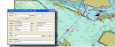
Eye4Software GPS Mapping Software v.3.0.10.927
Eye4Software GPS Mapping is a professional GPS mapping software tool that can be used in numerous applications. Use the software to load, view and edit your maps, display your position realtime and record all your movements.
GPS-Info CMM v.1.0
GPS-Info CMM is a Contextual Menu Module designed for Mac OS X.
3D Toolkit v.4.0.5
30 day trial version of the Electric Image / dvGarage 3D Toolkit.
Phantom Cine QuickTime Toolkit v.1.0
Phantom Cine QuickTime Toolkit is a complete toolkit to let users of Vision Research Cameras, to easily use the "Cine" file format.
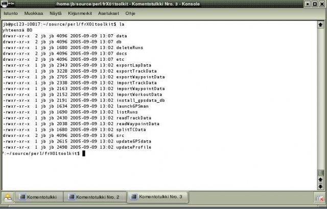
Forerunner X01 Toolkit v.1.10
ForeRunner X01 toolkit provides an easy access to Forerunner 201/301/305/305E GPS-units.
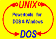
UnixDos Toolkit for Windows
UnixDos Toolkit makes the full power of 65 main UNIX utilities available under any DOS and Windows Environment. UnixDos allows you to do powerful tasks directly from the command line or batch files. In addition it provides 28 usefull utilities

Graybox OPC Server Toolkit
Graybox OPC Server Toolkit lets the programmer to create robust and highly effective OPC Servers within the shortest possible time. This toolkit eliminates the necessity of implementing all of the numerous OPC interfaces and COM programming. Graybox OPC

Icons-Land Vista Style GIS/GPS/MAP Icon Set v.2.0
Vista Style GIS/GPS/Map Icon Set is of perfect design quality. Being represented in 7 sizes, icons can be widely used in local service applications, GPS tracking and GIS applications, and any kind of mapping applications.